New California Wildfire Alert System is a Network of 1,000 Cameras
The University of California San Diego has launched a new cutting-edge system made up of more than 1,000 cameras positioned across the state designed to prepare for, respond to, and recover from wildfires and other natural hazards.
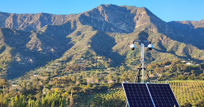
The system integrates and expands on what was formerly the ALERTWildfire camera network that is now known as ALERTCalifornia. The expanded state-focused program manages more than 1,000 pan-tilt-zoom capable cameras and sensor arrays across the entire state and collects data regularly that can provide real-time, actionable information that serves to inform public safety during natural disasters.
ALERTCalifornia debuts what UC San Diego calls an updated third-generation wireless camera network that prioritizes cutting-edge research in response to what it says are increasingly frequent and severe climate-driven disasters which include fires, floods, atmospheric rivers, and landslides.
“The program will spawn invaluable research and mitigation plans that will increase the state’s resiliency towards the new extreme fire risk,” Neal Driscoll, director of ALERTCalifornia and geoscientist at UC San Diego’s Scripps Institution of Oceanography, explains.
“Data acquired in the highest fire-threat regions will significantly empower firefighters, first responders, legislators, city planners, and scientists for years to come.”
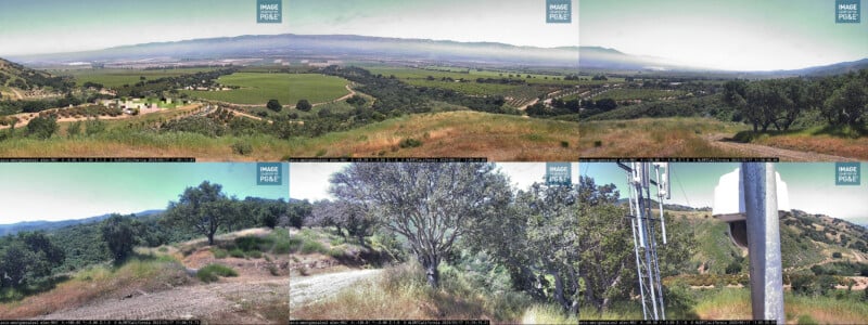
ALERTCalifornia replaces the previous system because it makes what UC San Diego characterizes as major camera network interface improvements and positions that information on a new, mobile-friendly, public website that features the ability to see the placement of every camera and access recent images captured by them at any time. It also includes several panoramic cameras that, when used in tandem with one another, can produce a 360-degree view of an area, such as the one below.
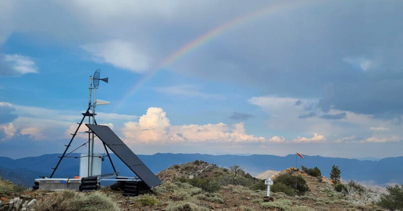
The size of the network is continuing to grow. Just this year, new cameras were added in Los Angeles, Santa Barbara, and Madera counties. These new high-definition cameras are able to pan, tilt, zoom and perform 360-degree sweeps and provide 24-hour monitoring with near-infrared night vision capabilities. Each camera can view as far as 60 miles on a clear day and 120 miles on a clear night. The cameras don’t provide a live feed on the public website, but they do refresh with relative frequency.
A live feed is available to select parties though, and UC San Diego says that the network has already been used to monitor the record-breaking snow pack in the Sierra Nevadas earlier this year, showcasing their use beyond wildfire mitigation.
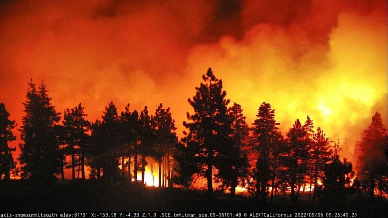
Some of the new installations have more than traditional cameras. Some incorporate infrared systems that allow emergency responders to identify hotspots and flare-ups through thick smoke and provide firefighters with real-time updates on evolving situations on the ground during a wildfire.
“The ALERTCalifornia team also made advancements in mobile field camera and sensor technology by creating small temporary platforms that are easily assembled and removed seasonally,” UC San Diego says. “These platforms fill the need for monitoring in high-risk areas with little to no impact to sensitive habitats and sacred tribal lands.”
The cameras provide even more value beyond responses in real-time. Data gathered by this system combined with the data from the previous ALERTWildfire network has allowed scientists to map huge swath of land to determine the status of fire-prone areas and plan for the future by researching forest health and mapping wildfire fuels.
“The collection of new high-density LiDAR and multispectral data will add to the program’s effectiveness and improve fire resiliency in California by accurately characterizing biomass, and as such, possible bio-fuels and moisture content, enabling analytics and extensive research on fuels and forest health, and mapping wildfire fuels to accurately model wildfire behavior,” Driscoll adds.
More than 30,000 square miles of high-density LiDAR and multispectral data of elevated and extreme risk fire threat regions have been collected and will allow researchers to gain a better understanding of these areas to predict and determine the impact of future disasters.
All of ALERTCalifornia’s cameras and their feeds can be perused on the organization’s website.
Image credits: UC San Diego, ALERTCalifornia